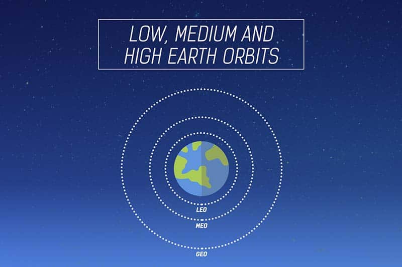
MEO satellites are positioned between two Van Allen Belts at a height of about 10,000 Km with a rotation period of 6 hours. One important example of the MEO satellites is the Global Positioning System (GPS) as briefly discussed below:
GPS
The Global Positioning System (GPS) is a satellite-based navigation system. It comprises a network of 24 satellites at an altitude of 20,000 Km (Period 12 Hrs) and an inclination of 55° as shown in Fig. Although it was originally intended for military applications and deployed by the Department of Defence, the system is available for civilian use since 1980. It allows land, sea and airborne users to measure their position, velocity and time. It works in any weather conditions, 24 hrs a day. Positioning is accurate to within 15 meters. It is used for land and sea navigation using the principle of triangulation as shown in Fig. It requires that at any time at least 4 satellites to be visible from any point of earth. A GPS receiver can find out the location on a map. Figure 5.10.11 shows a GPS receiver is shown in the caption’s cabin of a ship. GPS was widely used in Persian Gulf war.
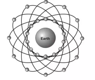
Global positioning system
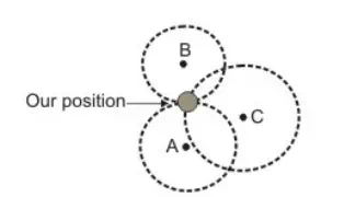
Triangulation approach used to find the position of an object
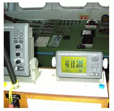
GPS receiver in a ship

Comments are closed